


This article covers the AI tools that can revolutionize autonomous drone route planning. These tools incorporate AI technology which autonomously plans the flight paths, guarantees mission safety, efficiency, and streamlines advanced navigation.
AI tools come in many variants as open-source, enterprise-grade and each type has different features.
What is Autonomous Drone Route Planning?
Autonomous Drone Route Planning refers to the cutting-edge use of AI and sophisticated algorithms to allow drones to plan and navigate their own flight paths completely autonomously—without human intervention.
Drones can figure out the most effective, secure, and unimpeded paths for an array of tasks, including delivery, mapping, surveillance, and agriculture.
Through the use of AI designed to analyze environmental data and integrate real-time updates based on weather and terrain, drones can adjust to changes mid-flight to optimize smooth operation, energy consumption, and mission success.
Benefits Of AI Tools for Autonomous Drone Route Planning
Greater Efficiency: Missions are completed in less time with AI algorithms optimizing flight paths for lower battery consumption and quicker mission fulfillment.
Greater Safety: AI safety tools minimizes the risk of mission accidents and failures by finding and eliminating obstacles, bad weather, and restricted areas.
Dynamic Decision Making: AI analytics allow drones to shift their routes in real time based on immediate changes to the environment, and new mission objectives.
Cost Efficiency: Operations spend less because automated fuel and battery usage control routed. More manual control lessens intervention to recharge or refuel.
Easier Expansion: AI technology is perfect for expansion since it allows control of several drones during large surveillance or logistics operations.
Predictive Insights: AI technology analyzes flight data for mission improvements while also predicting maintenance intervals for sustained and enhanced performance.
Best AI Tools for Autonomous Drone Route Planning Points
- ArduPilot – Open-source autopilot software offering intelligent flight control and path optimization for diverse drone missions.
- PX4 Autopilot – Advanced open-source flight control platform with AI integration for precise and adaptive route planning.
- DJI FlightHub 2 – Cloud-based AI tool for centralized drone fleet management and real-time route monitoring.
- UgCS – Professional mission planning software with AI-assisted 3D route mapping and terrain-following capabilities.
- Anvil Labs AI – Smart AI system that automates drone flight paths with predictive analytics for efficient mission execution.
- Auterion Suite – Enterprise drone management platform powered by AI for scalable route planning and data integration.
- SkyGrid – AI-driven airspace intelligence platform enabling safe, compliant, and optimized drone flight paths.
- AirMap AI – Real-time AI-powered air traffic management system ensuring safe navigation and route compliance.
- Skydio Autonomy – AI-based autonomous navigation system enabling drones to map, detect, and avoid obstacles intelligently.
- FlytBase AI – Cloud-connected AI platform for autonomous drone operations, smart route planning, and fleet coordination.
10 Best AI Tools for Autonomous Drone Route Planning
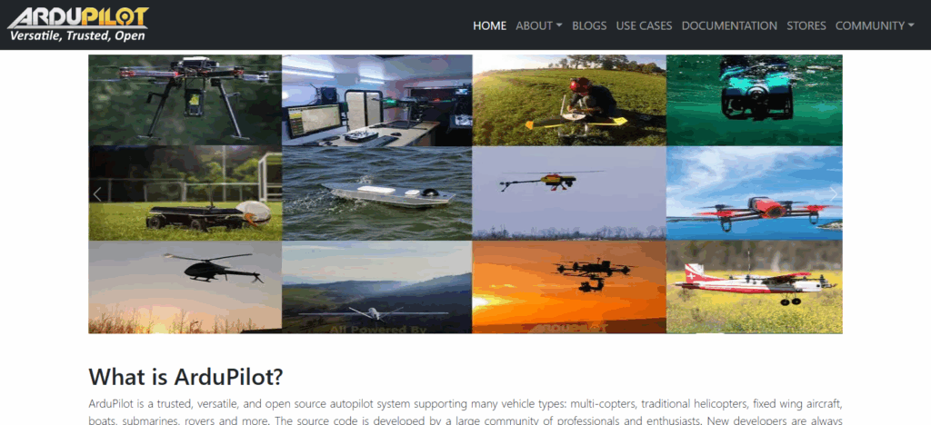
1. ArduPilot
One of the best AI tools for autonomous drone route planning is ArduPilot. Its intelligent flight control functions, flexibility, and open-source ecosystem make it stand out as one of the best AI tools for planning drone routes autonomously.
ArduPilot is capable of controlling drones of various sizes, ranging from small quadcopters to large fixed-wing UAVs, which is perfect for both analytical and commercial purposes.
Its AI-based algorithms allow for dynamic mission planning, obstacle avoidance, and route adjustments based on real-time environmental data, which optimizes the route cost.
Unique to ArduPilot is the developer community that encourages innovation, facilitating meticulous mission customization. This, paired with the ability to pioneer new sensor technology, provides dependable, efficient, and autonomous drone control for countless applications across diverse industries.
| Feature | Details |
|---|---|
| Tool Name | ArduPilot |
| Type | Open-source AI-powered autopilot software |
| Primary Function | Autonomous drone route planning and flight control |
| KYC Requirement | Minimal – open-source usage, no user registration needed |
| Supported Drone Types | Multirotors, fixed-wing, VTOL, and rover systems |
| AI Capability | Real-time route optimization and adaptive mission control |
| Key Advantage | Full customization with strong developer support |
| Deployment | Onboard or ground-based control software |
| Best For | Research, industrial automation, and custom drone projects |
| Unique Strength | Open-source flexibility with high precision flight algorithms |
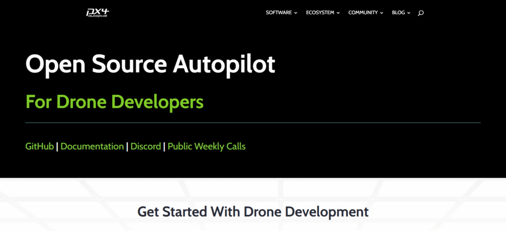
2. PX4 Autopilot
PX4 Autopilot is a remarkable AI tool for autonomous drone route planning due to its adaptability, precision, and strong performance. It is an open-source flight control platform for professional drone missions that employs brilliant AI path optimization along with real-time situational awareness.
PX4’s compartmentalized structure facilitates easy integration with custom AI, along with other hardware, sensors, and frameworks that allow the autonomous flight to make intelligent choices. Its uniquely constructed safety and predictive routing features allow hassle-free and safe operation over challenging areas.
PX4’s scalability and universal platform utility, which is the value proposition to clients, is what drives efficiency for intelligent autonomous drone system development.
| Feature | Details |
|---|---|
| Tool Name | PX4 Autopilot |
| Type | Open-source AI-enabled flight control software |
| Primary Function | Autonomous drone route planning and navigation control |
| KYC Requirement | Minimal – open-source platform, no account registration needed |
| Supported Drone Types | Multicopters, fixed-wing, VTOL, and ground vehicles |
| AI Capability | Intelligent path optimization and real-time flight adaptation |
| Key Advantage | Modular design for easy customization and integration |
| Deployment | Onboard flight controller or companion computer |
| Best For | Developers, researchers, and commercial drone solutions |
| Unique Strength | Scalable, cross-platform architecture with high stability and precision |
3. DJI FlightHub 2
DJI FlightHub 2 has been integrated into reputable AI solutions for the autonomous planning of drone routes, and offers the best cloud solution for integrated operating multiple drones.
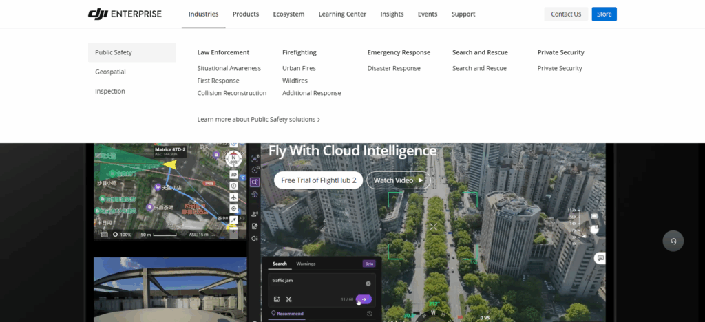
It merges the functions of mission coordination, route optimization, and real-time data visualization on an AI interface. Users can plan and control the drones on real-time 2D and 3D maps and can route the drones using the mapping tools and the terrain analyzer.
FlightHub 2 is also different since it is part of the integrated ecosystem, providing data to optimize collaborative mission control and AI-assisted planning, improving the efficiency, safety, and situational awareness of operations in surveying, security, and logistics.
| Feature | Details |
|---|---|
| Tool Name | DJI FlightHub 2 |
| Type | Cloud-based AI drone management and route planning platform |
| Primary Function | Centralized mission control, route planning, and real-time monitoring |
| KYC Requirement | Minimal – basic DJI account setup, no complex verification |
| Supported Drone Types | DJI enterprise and compatible drone models |
| AI Capability | Smart flight path optimization and live data processing |
| Key Advantage | Real-time collaboration and 2D/3D mapping visualization |
| Deployment | Cloud-based web interface and mobile access |
| Best For | Enterprise operations, surveying, and security missions |
| Unique Strength | Seamless integration with DJI ecosystem for efficient fleet management |
4. UgCS
UgCS (Universal Ground Control Software) has excellent AI tools for autonomous drone route planning. It is regarded for its accuracy, versatility, and professional mapping quality.
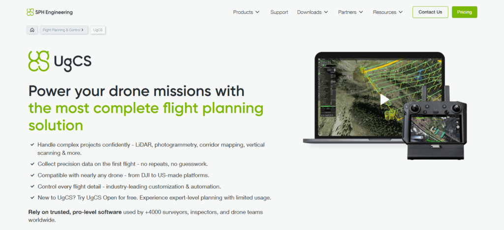
Users can generate intricate flight paths using UgCS’s AI-powered 3D route planning, terrain-following, and obstacle detection/avoidance features. UgCS is suitable for surveying, agriculture, and inspection as it works with many drone platforms.
Adaptive route changes based on real-time mission data and environmental conditions are possible because of real-time data processing. For large-scale detailed autonomous drone operations, UgCS is unrivaled because of its integration with external sensors and LiDAR systems.
| Feature | Details |
|---|---|
| Tool Name | UgCS (Universal Ground Control Software) |
| Type | Professional AI-assisted drone mission planning software |
| Primary Function | Autonomous route planning, terrain-following, and 3D mapping |
| KYC Requirement | Minimal – simple license activation, no detailed verification |
| Supported Drone Types | Multirotors, fixed-wing, and VTOL drones |
| AI Capability | Terrain-aware path optimization and obstacle avoidance |
| Key Advantage | Precise 3D route planning for complex environments |
| Deployment | Desktop software with real-time flight data integration |
| Best For | Surveying, mapping, and industrial inspection operations |
| Unique Strength | Advanced terrain-following with external sensor and LiDAR support |
5. Anvil Labs AI
One of the most advanced autonomous drone route planning tools, Anvil Labs’s AI offers intelligent automation and adaptive mission control.
It uses advanced machine learning techniques to assess digitized flight data, analyze terrain features and patterns, and determine environmental variables to construct optimized and safe flight paths.
Anvil Labs’s AI specializes in predictive route changes to maintain operational seamlessness and efficiency during complex tasks. Its core differentiator is the ability to execute real-time adaptations—drones can permanently change their routes according to real-time data.
This is primarily useful in high-precision industries like logistics, drone-assisted inspection, and disaster management, where operational reliability and autonomy highly matter.
| Feature | Details |
|---|---|
| Tool Name | Anvil Labs AI |
| Type | AI-powered drone route automation platform |
| Primary Function | Intelligent flight path creation and adaptive mission control |
| KYC Requirement | Minimal – basic access without complex user verification |
| Supported Drone Types | Compatible with major commercial and custom drones |
| AI Capability | Predictive route optimization and real-time decision-making |
| Key Advantage | Dynamic route adjustments based on live environmental data |
| Deployment | Cloud-based platform with automated control interface |
| Best For | Logistics, inspections, and emergency response missions |
| Unique Strength | Real-time adaptability and predictive flight intelligence |
6. Auterion Suite
Auterion Suite has become one of the best AI tools for planning autonomous drone routes because of its seamless data integration, scalability, and enterprise-grade intelligence.
Auterion Suite connects drones with the ground and the cloud systems, creating one cohesive unit for mission planning and fleet management. Leveraging AI, Auterion Suite predicts the best and legally compliant routes for each drone.

It considers mission objectives, and analyzes weather and terrain data so that the drones can avoid hazards.
Auterion Suite is unique because organizations can operationalize and framework customization because Auterion Suite is cloud-connected. This makes the tool an agile solution for enterprises and government drones where multiple drones can be managed autonomously.
| Feature | Details |
|---|---|
| Tool Name | Auterion Suite |
| Type | Enterprise-grade AI drone management and route planning platform |
| Primary Function | Autonomous mission planning, fleet management, and data integration |
| KYC Requirement | Minimal – account setup only, no extensive verification |
| Supported Drone Types | PX4-based and compatible enterprise drones |
| AI Capability | Smart route optimization and automated mission execution |
| Key Advantage | Unified cloud ecosystem for managing multiple drones efficiently |
| Deployment | Cloud and edge-based operation platform |
| Best For | Enterprise, defense, and industrial drone operations |
| Unique Strength | Open-source foundation with scalable AI-driven mission control |
7. SkyGrid
SkyGrid represents advanced innovation for autonomous drone route planning. It serves operational safety and airspace intelligence. It uses AI and blockchain for real-time route optimization and predictive risk assessments.
To determine the safest and most efficient drone routes, it reviews flight data, weather conditions, and airspace restrictions. What makes it exceptional and the most valuable for extensive commercial drone applications is the combination of AI with blockchain which facilitates secure data exchange, operational traceability, and compliance.
Moreover, large-scale commercial drone deployments for logistics and infrastructure monitoring, as well as urban air mobility, would benefit from it due to seamless compliance and operational control.
| Feature | Details |
|---|---|
| Tool Name | SkyGrid |
| Type | AI and blockchain-based airspace management and route planning platform |
| Primary Function | Autonomous drone route optimization and air traffic coordination |
| KYC Requirement | Minimal – basic registration, no extensive verification needed |
| Supported Drone Types | Commercial and enterprise-grade autonomous drones |
| AI Capability | Real-time flight path prediction and risk analysis |
| Key Advantage | Secure and transparent data handling through blockchain integration |
| Deployment | Cloud-based and mobile-accessible interface |
| Best For | Logistics, infrastructure, and urban air mobility operations |
| Unique Strength | AI + blockchain fusion for safe, compliant, and intelligent drone navigation |
8. AirMap AI
AirMap AI stands out as one of the top AI technologies for autonomous drone route planning due to its sophisticated airspace management and route planning abilities.

It uses AI to evaluate real-time data on air traffic, weather, and drone operation zones to maintain safe and legal drone operation. By considering changing conditions and risks, AirMap AI provides real-time updates to assist situational awareness.
Its close integration with the world’s aviation systems is what sets AirMap AI apart, as it allows real-time coordination of autonomous drones with piloted planes. For organizations and agencies that value safe and efficient autonomous drone operation, as well as legal compliance, AirMap AI is the ideal choice.
| Feature | Details |
|---|---|
| Tool Name | AirMap AI |
| Type | AI-powered airspace management and route planning platform |
| Primary Function | Safe and compliant autonomous drone route planning |
| KYC Requirement | Minimal – simple account creation, no detailed verification |
| Supported Drone Types | Commercial, enterprise, and government drones |
| AI Capability | Real-time air traffic monitoring and dynamic route adjustment |
| Key Advantage | Seamless integration with global aviation and regulatory systems |
| Deployment | Cloud-based platform with real-time operational updates |
| Best For | Airspace compliance, delivery, and surveillance operations |
| Unique Strength | AI-driven airspace intelligence ensuring safe and optimized drone flights |
9. Skydio Autonomy
Skydio Autonomy is regarded as one of the most advanced AI systems for autonomously planning drone flights. It is also considered one of the best for real-time navigation systems along with obstacle avoidance.

Drones equipped with Skydio Autonomy can make flight decisions in real-time without human intervention as the AI system does 3D environment mapping. Skydio Autonomy is able to optimally adjust its paths in real-time for maximum safety and efficiency as it learns and constructs new models from the data it continuously collects.
It is best in complex and analog GPS space due to its precise movements aided by advanced computer vision and deep learning algorithms. It is superb for defense, inspections, and monitoring critical infrastructures since the tasks require great reliance, precision, autonomy and the most advanced systems.
| Feature | Details |
|---|---|
| Tool Name | Skydio Autonomy |
| Type | AI-driven drone autonomy software/engine |
| Primary Function | Autonomous route planning, navigation & obstacle avoidance |
| KYC Requirement | Minimal – basic account/enterprise registration, not heavy verification |
| Supported Drone Types | Skydio enterprise drones (e.g., X10, S2 series) |
| AI Capability | 360° obstacle avoidance, real-time 3D mapping, predictive flight decisions |
| Key Advantage | Expert-pilot level autonomy built into the drone enabling safe missions even in complex, GPS-denied environments |
| Deployment | Onboard AI engine integrated into drone hardware + software stack |
| Best For | Enterprise inspections, situational awareness, search & rescue, infrastructure monitoring |
| Unique Strength | Real-time environmental understanding via deep neural networks and 3D modelling enabling highly autonomous route planning and flight execution |
10. FlytBase AI
FlytBase AI is one of the most effective AI systems available for autonomous drones route planning. It is built for large-scale interconnected drone operations. It provides autonomous planning of route optimization, mission scheduling, and fleet coordination on a cloud centralized platform.
With FlytBase AI, users get to generate flight paths which are dynamic and made of various available data. These paths change according to the real-time operating environment and to any operational situation.
Being able to incorporate borderless IoT devices and cloud APIs provides fully autonomous workflows which cut across different verticals such as agriculture, logistics, and drones security. It is cloud-enabled for real-time supervision and autonomous planning on the fly. FlytBase AI provides safe and intelligent drone mission optimization across the world.
| Feature | Details |
|---|---|
| Tool Name | FlytBase AI |
| Type | Enterprise AI-powered drone autonomy and route planning platform |
| Primary Function | Automated route optimization, fleet management, mission scheduling |
| KYC Requirement | Minimal – basic account registration, no extensive user verification |
| Supported Drone Types | Commercial and enterprise drones (docked and non-docked systems) |
| AI Capability | Real-time edge AI for object detection, live mission adaptation, cloud/edge integration |
| Key Advantage | Hardware-agnostic platform, scalable from single drone to large fleet, strong data-security architecture |
| Deployment | Cloud-based, on-premises or hybrid network, supports global enterprise setups |
| Best For | Large-scale operations like infrastructure inspection, logistics, security |
| Unique Strength | Combines autonomous route planning with live fleet coordination and enterprise-grade AI workflows |
Conclusion
AI-equipped systems for autonomous drone route planning are redefining drone missions in all sectors for increased accuracy, enhanced safety, and optimized mission value. ArduPilot, PX4 Autopilot, DJI FlightHub 2, UgCS, Anvil Labs AI, Auterion Suite, SkyGrid, AirMap AI, Skydio Autonomy, and FlytBase AI have all proven invaluable under various circumstances.
Providers range from open-source systems to enterprise-grade solutions with real-time flexibility. Drones perform route-optimizing and autonomous decision-making to sustain missions. More of AI’s advances will strengthen the value of autonomous drone operations and unlock scalable, safe, and globally applicable uses.
FAQ
Why are AI tools important for drone route planning?
They eliminate manual flight control, reduce errors, enhance safety, and ensure optimal energy use, allowing drones to operate independently and effectively in complex environments.
Which are the best AI tools for autonomous drone route planning?
Some of the top tools include ArduPilot, PX4 Autopilot, DJI FlightHub 2, UgCS, Anvil Labs AI, Auterion Suite, SkyGrid, AirMap AI, Skydio Autonomy, and FlytBase AI.
Do these AI tools require KYC verification?
Most of these tools, especially open-source and enterprise platforms, require minimal or no KYC, allowing users to access and deploy them easily for professional or research use.
Can AI drone route planning tools be used for any type of drone?
Yes, many tools support multiple drone types such as multirotors, fixed-wing, and VTOL models, depending on the platform’s compatibility and mission requirements.